
but it still turned out to be a pretty good ride. You know what they say-the worst day riding your motorcycle is better than the best day at home, or at work, or fishing, or...
The best rides are the ones that you screw up but you still find some neat places off where you least expected to go, some neat roads beyond those that show up in Mapquest, and can still have an awesome ride.
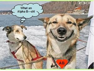
I also just realized today that this marks almost 6 months after the winter ABAF (Alpha Bitch Ass Freezer) that we all took in January of this year, and almost on the same route.
(see below for a detailed overview regarding ride planning)
I am so grateful I ride with the best riders I know.
The best rides are the ones that you screw up but you still find some neat places off where you least expected to go, some neat roads beyond those that show up in Mapquest, and can still have an awesome ride.
I also just realized today that this marks almost 6 months after the winter ABAF (Alpha Bitch Ass Freezer) that we all took in January of this year, and almost on the same route.
(see below for a detailed overview regarding ride planning)
I am so grateful I ride with the best riders I know.
We met at Johney’s at 9:30 AM & took off around 9:30 AM-ish.
I kind of missed the Pala turn off and kept going for another 8 miles down the freeway and finally got off at the Fallbrook exit. The guys went along with me, figuring I knew where I was going.
We got off, I told them what I did, and the consensus was to continue down the old 395 side road paralleling the east side of the 15 freeway which looked interesting then perhaps get back on the 15 north to Temecula. We passed by this place called, “Rainbow Oaks” in the town of Rainbow.


Turns out that the Rainbow Oaks Restaurant at
 the County Line was a great place! Neat restaurant, had a bar and shaded patio area, a picnic area, country store, gas, pretty cool. My open faced hot meat loaf sandwich was GREAT, (even though I could only eat 1/3 of it) and Bub’s biscuits and gravy was not bad, not bad at all. The sausages were huge. Johney’s eggs and sausages with home fried potatoes and toast, Bub’s biscuits and gravy came with 2 eggs and 4 sausages and my meatloaf sandwich with mashed potatoes was great
 Below left, Johney's plate.
  My HUGE open face hot meatloaf sandwich on garlic toast with mashed potatoes is above, right & Bub's biscuits and gravy with 2 eggs and 4 really big sausages below right.
  I could only eat about 1/3 of it, but the boys helped me. Check out the map below, and try it, you’ll really like it.
That mistake I made turned out to be a REALLY positive thing. I’ve noticed that a lot of times the most unexpected rides and places can be the most fun and rewarding. If you're not constantly berating yourself for screwing up.
We asked the waitress how to get to Julian, and she asked someone else who told us to go down the street we were on, pass the golf course, turn right at the light, then turn left onto Hwy 76.
NOTE TO MYSELF/HELPFUL HINT-when printing out maps, make sure to print out area maps with a 5 mile radius AT LEAST, to be able to figure out where I am if I take a wrong turn. I don’t have a Thomas Guide for my motorcycle, just the maps I print out.
I decided that we should go right on to Palomar Mountain since we’d already eaten and that the only real reason to go to Julian was to have lunch. We went past the turn-off to Valley Center and I saw that my gas tank was very close to 100 miles. I don’t let it get past 120 before getting gas (see below) so I was a tad worried.
 $3.29 for regular unleaded, but who cared? It saved us another 45 minutes going to Santa ysabel and back, and with 4 gallons, that amounted to about $1.60 more than home. BFD.
We tootled on back up 76 and got onto S6 going to Mt. Palomar. Let me tell you, S6 is a spastic upper and lower intestine compared to the spastic colon Glendora Mountain Ridge Road! That sucker was REALLY CURVY.
 Stopped at the country store and bought some pins there, then went on up to the Observatory.


Of course, we all have to pose in front of the Main Event, below.

 Anyway, about the Observatory:the last and first time I was there was when I was about 7 years old, in the 1960’s. It was huge and impressive then as now.
 Went in, saw the telescope.

 I am DEFINTELY learning what's good and what's not with picture taking. The Observatory pics I took could REALLY be postcards, IMHO. We hit Palomar Mountain around 1:10 or so, which was almost about the time I thought we would originally, so that worked out pretty good. See the telescope area video, below.
We went into the most important place-the gift shop.

 After the Observatory we rode S7 which is an easier road albeit longer. Saw a really neat observation area that seemed really new, pulled over, took some pics, and Barry always has a nice smile, nice presence.
  Johney, on the other hand, usually has a nice smile, but sometimes …well, you can see the pic. I am someday SO gonna put him out of his misery.
 (YOU didn't think I'd post it, DID YOU, Mr. PITA?!)
We got into Temecula and stopped at a Rubio’s for sodas and a small taste of something. Their grilled chix quesadilla is pretty damn good. Got on the 15 north, the traffic was GREAT, so I pulled into the #2 lane and started going 75. Then 80. Then 85. Stayed around 85 in the left lane, occasionally went up to 88-90. I noticed ONE TIME that I was at 91, which didn’t seem so comfy (it was actually surprising because it didn't FEEL like 91, even on my tinker toy of a bike) so I went down to a more manageable 85. Note to myself-do a T-CLOCS tightening of EVERYTHING I can get my hands on!!! My bike tends to shake and vibrate more, so things come looser more easily, as I have experienced before.
The other good thing about going on Saturday was that Saturday the 4th had not so much traffic vs. Sunday the 5th, when everybody would be coming home. The 15 was running awesome at 80-85, the 91 freeway was even running great from the 15 to the 57, around 75, and I usually NEVER take the 91. Today (Saturday) I checked out the right lane for the people on the 15 N going onto the 91 W (all good), checked out the overpass from the 15 N to the 91 W (still all good) and finally a quick glance at the traffic coming from the east going west on the 91 (awesome). It worked out really really well. My guys said that they’d follow me no matter which way I went, 15 to the 60 or the 91, but I figured that it would be more helpful for all to go 91.
HOW I PLAN RIDES: (skip this part unless you're really, REALLY interested-otherwise, it's gonna be boring as hell to you)
What I do is figure out where I want to go, the place I’d leave from, Mapquest those two locations, then check that map and figure out additional locations between those locations for gas, food, etc. It’s kind of a multi-part process because I have to know the route and destination, but also note how long it would take to get to that destination, how many miles are involved then add in any food or gas stops. Mapquest gives you mileage and appx. time/duration, so I start a spreadsheet and list the initial 2 locations from/to, figure the mileage and time, then add rows in between the initial start place and the ultimate end place, with additional locations/travel duration for gas stops and the time; food stops and the travel mileage and duration, etc.
½ DAY EXAMPLE: I had decided that we’d leave Orange at 12:30 and meet another member of the group in Corona. The spreadsheet showed From: Orange and To: Corona, 20 miles, 22 minutes. So we were to meet Tommy at 1:00 in Corona and top off our tanks. That made the new starting point (for gas purposes) was Corona, with the eventual end point the OC (for us). The total mileage for the entire day was appx. 236, from the OC to Corona to Mt. Palomar, around Hwy 79 to Temecula then back to the OC. A few of us have smaller tanks so I put a limit of around 100-120 miles on a tank. Reserve for Barry and I have been 130 and 144 respectively (with varied mountain and slab riding), hence the mileage limit. Johney and Tommy’s bikes have much larger tanks and so can go farther, but that doesn’t help us if we hit reserve on the top of Mt. Palomar and STILL have appx. 64 miles back to Temecula, with our bikes getting about 45 MPG! That’s about 19 miles on dry-dirt empty. I figure out mileage and gas up locations. From Corona to Palomar Mountain is 73 miles. All good, BUT what about the ride from Mt. Palomar to Temecula via Warner Springs and Aguanga?? That leg is 64 miles, which made a total 137, PLUS route S6 up to Palomar is a very twisty turney road so would potentially use more gas with the constant down-and-upshifting. I had to figure out a place where we could get gas before Mt. Palomar, and based on the route I had picked, turned out to be Pala. I added a row into the spreadsheet with a From: Corona and a To: Pala, 50 miles with a gas-up. Now the new start point (for gas purposes) was Pala. The next legs of the trip were Pala-Mt. Palomar, Mt. Palomar-Aguanga, and Aguanga-Temecula, for 87 miles total those three locations, with the final location theoretically home to the OC, adding another 60 miles. We needed another gas stop because the mileage for the route from Mt. Palomar to the OC would’ve been 147, over the 120 limit. So the final gas location was Temecula. After the gas stops are ID’d, I then do a time-duration calc. OC to Corona is 22 minutes, so since I usually do time calcs in ¼ hour increments, I counted it as ½ hour. Since it was a top-off gas stop, I added ¼ hr aka 15 minutes to the total duration. During the time – duration planning, I also figure in the TIMES we’ll hit each location. OC to Corona is ½ hour, so leaving at 12:30, get to Corona by 1. Add 15 minutes, so we leave Corona at 1:15. The next stop was Pala (the gas stop) at 50 miles and 53 minutes, so I plan an arrival time to Pala at 2:15, add 15 minutes for gas, then leave Pala at 2:30. And so on. For food stops, I add one hour. If we leave their ahead of schedule, good. If we leave a little later, still ok because I’ve rounded up the location duration (sounds pretty cool, doesn’t it? “Location Duration”) for extra minutes trip padding.
Locations that we stop at usually have a reason-gas, food, activity, or photo op. I have to make sure that there IS gas available and food available by searching for restaurants in that area and checking out their menus, seeing the reviews on TripAdvisor, etc.
After I do the route, times, gas, mileage, I do the TEMPERATURES. Yup, ya gotta figure out if it’s gonna even remotely rain anywhere near where you’re gonna be, or will it be an ass-freezer or an ass-fryer? Hey, the AB has a rep to protect, so I do an initial 10 day check then 3 day check of the weather for all the stop locations, then 36 hours beforehand I do an hourly check for that location at that time. Corona was going to be 1:00 PM on the ½ day ride, so the temp was going to be around 80. I do that for most of the locations that will obviously be different, such as the OC, Corona, Temecula, Palomar Mountain.
I then do a final check, print out various sizes of the maps, some of the routes if they’re twisty, and go into a Zen-like consciousness to see if I’ve forgotten anything.
This type of planning allows me to have a margin of error for unforeseen circumstances and gives me the capability to identify gas stops.I mention this because this explains what was planned vs THE END RESULT, and how the full modified day I planned kinda went awry due to an initial navigating error on my part. I HATE IT when I don’t know specifically where I’m going or the miles.
1 comment:
I did the same basic route to Palomar a few weeks back as you mention. Went thru Rainbow valley as well. Awfully detailed report and I lost track a bit, but you all had a great time. That meatloaf sandwich could be used for ballast in case the 650 was riding kinda light. I had thought the ride was going to be Sunday, don't remember what I did Saturday. I will be looking for the condensed version shortly.
Post a Comment